To complement our (the Environment Agency’s) publication of open data on river levels, we have now made near real-time rainfall data available via an API.
This data is already used by the Environment Agency to assess water resources and provide local Flood Warning and Forecasting services. The data from some gauges is also used by the Met Office to calibrate rainfall radar data, which in return improves our Flood Forecast predictions.
We are publishing this data openly as it has the potential for a wide range of uses externally such as flood forecasting, farming, and recreation.
Why do the Environment Agency have their own rainfall network?
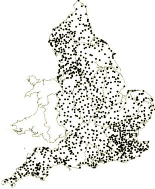
We are required to provide flood warning and water resource assessment at a much higher resolution than the Met Office rain gauge network is currently capable of. For this purpose we run our own network of automatic rain gauges across England, which are maintained by local Hydrometry teams. Real-time data from these gauges undergoes a quality assurance process before being backed up in our Hydrometric measurements archive.
We also manage a network of manually-read gauges operated by public volunteers, which along with the automatic gauges provide a rich archive of reliable, long-term data. This is used by government bodies, industry and researchers to model and inform weather and flood forecasting for water resource management, climate research and the wellbeing of communities.
How are we making this data available?
We wanted to make data available via an API so that we could enable innovation, wider use of data collected with public money, and better outcomes for our environment. The data release complements the official warning service of the Environment Agency – Floodline Warnings Direct – which provides to over 1.1 million properties in England and Wales.
Technical details
Data is transferred via telemetry to internal and external systems in or close to real-time. This data may be transferred to these systems or users at different intervals, varying for example from once-per-day during normal conditions, to several times per day during a flood event. Sometimes automatic collection is delayed for various reasons such as maintenance, system outages or failure of the public telemetry links. To ensure gauges are kept as up-to-date as possible in case of these occurrences, they are monitored continuously for faults.
For more information, please email sam.everitt@environment-agency.gov.uk
2 comments
Comment by Simon Jeavons posted on
thanks for the data, it's live on http://www.gaugemap.co.uk right now.
Comment by Liam posted on
This is brilliant.