Earth Observation technologies help us to understand how our actions affect our environment and are key to delivering better services through smarter use of data.
Monitoring our chemical, physical and biological environment is crucial to understanding where, how, and why our Earth is changing. We rely upon the environment for the food we eat to the space we inhabit. Our relationship with the environment is complex; we are dependent on it, whilst we also can put pressure on it, or change it for the better or worse. The development and increasing sophistication of remote sensing technologies has brought a revolution in Earth Observation (EO) and enabled the large-scale harvesting of environmental data that allows us to observe and understand changes and the impact of our actions. Earth observations present an incredible opportunity as a valuable tool with real-world applications, delivering policy in a cheaper, more effective manner across a diverse range of policy operations.
The Earth Observations Centre of Excellence (EO CoE) was established in November 2015 to ensure earth observations are used across the Defra group to their maximum potential. I recently heard what the EO CoE collaboration has achieved so far and how the Centre is improving working practices, just over a year from the programme’s inception.

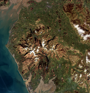
Earth observations from satellites, such as Sentinel 1 and 2, generate immensely large and complex raw datasets. In order to use these large datasets effectively the data must be made analysis-ready. Previously satellite data was processed for specific individual projects; however this approach can be time and resource intensive and therefore costly. The EO CoE has reduced the duplication of processing and introduced data standardisation, thereby reducing cost and improving productivity. The EO CoE has also developed the automated processing of satellite data. For example, Sentinel 1 radar data is transformed into a more readily usable data format, and atmospheric distortion and cloud cover is removed from Sentinel 2 optical imaging data. The processing of raw data can improve the accessibility of the information, thus reaching a far wider audience.
Alongside the development of analysis-ready data, there remains the need to access, and share this data effectively. Through the Defra Data Programme, the EO CoE Collaboration Platform, led by JNCC, was established to improve data-sharing facilities. The cloud-based online platform will enable the processing of data centrally and provide webmapping services, mitigating the need to download large data files and the associated issues that accompany the size of such files. This service enables the selected targeting of data and easier handling of data, with the promising prospect of resourceful application across several areas of operations.

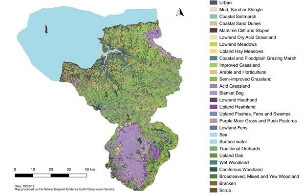
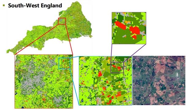
As well as developing data processing and sharing facilities, the EO CoE has produced a series of multi-purpose EO maps which can readily be used and adapted for specific purposes. For example, EO has enabled the dynamic monitoring of the annual change in crop cover, and the Rural Payments Agency (RPA) – through the CoE – have produced a crop map for England from radar data. This map can be used to inform the Common Agricultural Policy (CAP) Basic Payment Scheme. This crop information can now be incorporated into the vegetation maps being produced by Natural England through the CoE. Other projects assess the application of innovative data and products to a broad range of policy operations. EO can be used to describe habitat extent, detect landscape change and system response, and target risk based monitoring. For example, EO is being used operationally to streamline the RPA's land change detection with the automated monitoring of greening requirements under the CAP, reducing the number of field inspections.

EO has also been applied to target water quality monitoring. The Water Framework Directive requires the monitoring of UK rivers’ water quality. Currently the Environment Agency annually collects 250,000 water samples from 19,000 chemical and 6,900 ecological monitoring sites. This sampling process is costly and would benefit from the provision of information to better target monitoring sites. This project has shown how annual EO-based products, together with other existing data sources such as soil and slope, can be combined to assess risk of diffuse pollution at localised and catchment scales. This information assists the targeting of sampling activities and thus reducing sampling costs and impact. Operationally EO information on crop and land cover has been used to identify areas of bare soil vulnerable to runoff causing sedimentation and associated nutrient pollution of rivers.
It is clear that through the CoE’s collaborative approach the programme has excelled in innovative thinking and has developed the operational use of earth observations. The EO CoE exemplifies a successful framework for collaboration and innovation, creating a hub of knowledge and data sharing and delivering an amazing broad range of operational innovation with earth observations.
Recent Comments