Now that four of the European Space Agency’s Sentinel satellites are operational (Sentinel-1 a and b, Sentinel-2a, Sentinel-3a), there is a huge opportunity for Defra, along with many other UK government departments and organisations.
The regular refresh of openly accessible data allows us to detect potentially quite subtle changes in the environment, but before this is possible the raw data need to be cleaned ready for use.
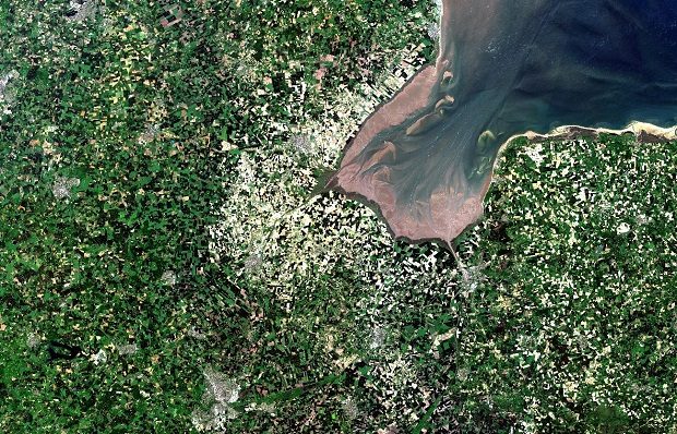
Sentinel satellites have optical sensors that detect the sunlight reflected from the Earth’s surface, and radar sensors that record microwaves pulses transmitted and bounced off the landscape below. One problem for optical sensors in particular is atmospheric distortion. To the human eye, this distortion is noticeable, but quite subtle. It is probably most apparent where two images are put together and there is an obvious line on the composite image (see image below). These differences become much more critical when we start analysing the data and attempting to detect quite small differences between images.
As a result, one of the first things we need to do is clean the images to correct for the effect of the atmosphere. This works by generating a model of the atmospheric conditions at the time the images were acquired. The model is then used to remove these conditions from the images generating a surface reflectance or bottom-of-atmosphere image.
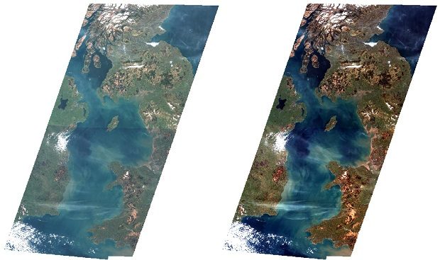
Most users of satellite data will need to first perform this correction, so if we can establish a central mechanism to do this, it improves efficiency and enables much more use of the data. The Joint Nature Conservation Committee (JNCC) have been working to with academia and industry to both agree and apply necessary standards and are producing processed datasets of both Sentinel-1 (radar) and Sentinel-2 (optical) images for the UK. Sentinel-1 data is being produced through a contract with Environment Systems Ltd, while Sentinel-2 is currently being produced by JNCC. The images below show a before (left) and after correction for Sentinel-2.
This work is part of wider efforts of embedding EO in Defra and across government, funded and supported by the Defra EO Centre of Excellence (EOCoE) and the UK Space Agency’s Space for Smarter Government Programme (SSGP).
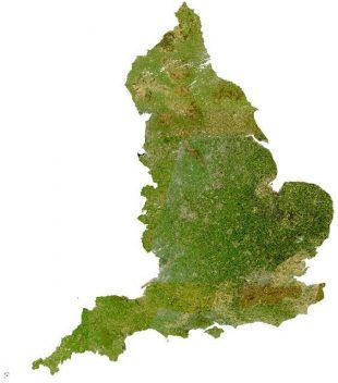
Through the EOCoE, these datasets have already been distributed and used to generate products by numerous organisations, not only within Defra but with organisations in Scottish and Welsh government-related organisations too. This includes a Sentinel-2 mosaic of England created by the Rural Payments Agency, which was used as a visual product for validating data sets used in internal processes.
Even with just four satellites streaming back data (there will eventually be 6 Sentinel constellations), the volumes are high. The Data Programme has been working with JNCC to explore how the necessary processes can be automated turning raw data from the satellites into a format ready for analysis and making this almost immediately available to potential users.
The need for this is much broader than Defra and there are plans for a fully operational version known as UK Government Earth Observation Service (UKGEOS) are underway.
The proofs-of-concept that Defra are producing is being seen as the first prototype of this service.
2 comments
Comment by Alun Edwards posted on
Diddorol iawn!
Comment by Ashraf Afana posted on
Nice work and effort. National Trust is trying to build a working procedure for habitat and land cover mapping using Sentinel data. Would be interesting to join efforts for such approach.