Monitoring Llangarron water quality from space
Posted by:
Andrew Richman, Geomatics Project Manager, the Environment Agency and Crispin Hambidge, Geomatics Consultant, the Environment Agency, Posted on:
-
Categories:
Data Transformation, Defra digital, Defra Science and Innovation, Defra services, Earth Observation, Open data
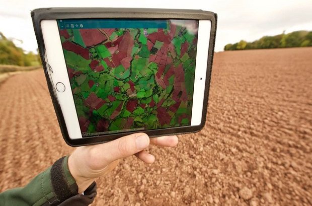
Environment Agency Geomatics experts Andrew Richman and Crispin Hambidge explain how satellite and LiDAR are helping Enforcement Officers identify agricultural runoff.
Recent Comments