Open data
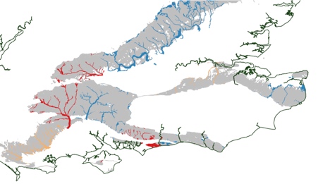
Currently 1.8 million people live in areas at risk of flooding across the UK. With an increasing population and dependence on flood plains for housing and industry, loss of natural flood defences and increased likelihood of extreme weather events; this …
GeoSmart Information combines Environment Agency open data with modelling in its GWFlood groundwater flood forecast service. Our model At GeoSmart, our model predicts groundwater levels based on actual history of all the main variables affecting groundwater recharge, flow and discharge …
For #InvasiveSpeciesWeek and to mark the release of the Centre for Ecology and Hydrology's Asian Hornet Watch app, we have a guest post from Janet Dixon from Defra's Exotic Disease Control Unit.
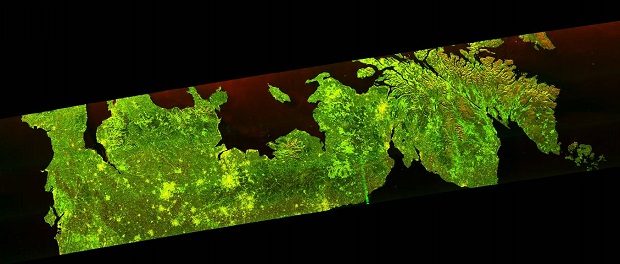
Our forests are valuable to us in many different ways – something we’ve understood for a long time. Now we have a new way to keep an eye on them.
The 2018 climate projections are coming and will be published as open data. Find out what they are and how to register for updates here.
Defra's Permanent Secretary talks #DataDrivenDefra, #DataMash and the joy of unconferences in this video and full transcription.
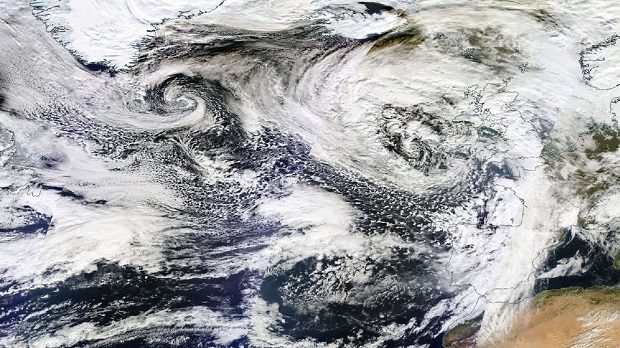
A week ago today I was lucky enough to attend the Sentinel-2B satellite launch event held at European Space Operations Centre (ESOC) in Darmstadt, Germany.
Every organisation has its commonly used phrases and, since starting in Defra in October, I keep hearing people use the term ‘we aren’t trying to boil the ocean’. It’s an evocative term, but we could use it to describe Data …
Much of Defra’s work relies on good access to, and use of, various kinds of geographical data. At present Defra has numerous local repositories within individual organisations which, in addition to being costly to maintain, can also lead to problems …
Past incarnations of this working group have been no stranger to ambitious targets, and the latest is no exception. The group, which I am a part of, comprises Defra Data Programme Leads, Data Managers, Senior Managers and Solutions Architects from …


Recent Comments