Data Transformation
Every organisation has its commonly used phrases and, since starting in Defra in October, I keep hearing people use the term ‘we aren’t trying to boil the ocean’. It’s an evocative term, but we could use it to describe Data …
Much of Defra’s work relies on good access to, and use of, various kinds of geographical data. At present Defra has numerous local repositories within individual organisations which, in addition to being costly to maintain, can also lead to problems …
Past incarnations of this working group have been no stranger to ambitious targets, and the latest is no exception. The group, which I am a part of, comprises Defra Data Programme Leads, Data Managers, Senior Managers and Solutions Architects from …
On a recent visit to Ordnance Survey (OS) I learned about the diversity of geospatial data and innovation OS undertakes. OS was born in 1791 under the ambition of creating a superior map of Britain. While world-famous for their paper …
The global population is rapidly expanding, increasing pressure on our finite resources and ability to produce food. In addition the food that we do have is not currently in the areas where it is needed most. We are facing a …
#DefraData's Tim Ashelford compares his first experiences with free and open source geographical information software QGIS with proprietary alternatives. He is joined by QGIS pro Alexandra Kilcoyne from Natural England.
Build a community in the Department for Environment, Food and Rural affairs (Defra) for data professionals? Our survey said…. X
We had a chance to speak to Sarah Hendry about what #DataDriven Defra means to her, and also to hear about her own hashtag: #NobelNostalgia.
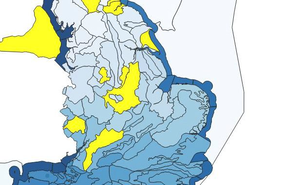
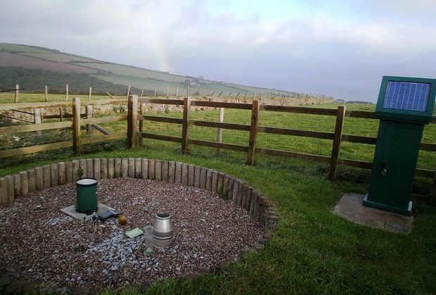
To complement our (the Environment Agency’s) publication of open data on river levels, we have now made near real-time rainfall data available via an API.
Do you feel like sometimes you're working in a vacuum; no one really understands the data publishing problems you have and no-one can help? Well, welcome to the Data practitioners' group – they can solve them all! Well maybe not …


Recent Comments